Please read this copy of an email I sent to Judith Harvey, Warden Team Co-ordinator of the Brecon Beacons National Park, who failed to respond. This was sent on the 26th September 2022. I will then detail the situation at the location post the drowning of the two women near Ystradfellte:
Waterfalls Path Closure
‘Hi Judith, Can I have your thoughts on this, please? I'm fed up with re-directing the lost and given my complaints in the past and your knowledge of this location why has remedial work on the path in question not been undertaken already? And can I ask when will this path be re-instated?
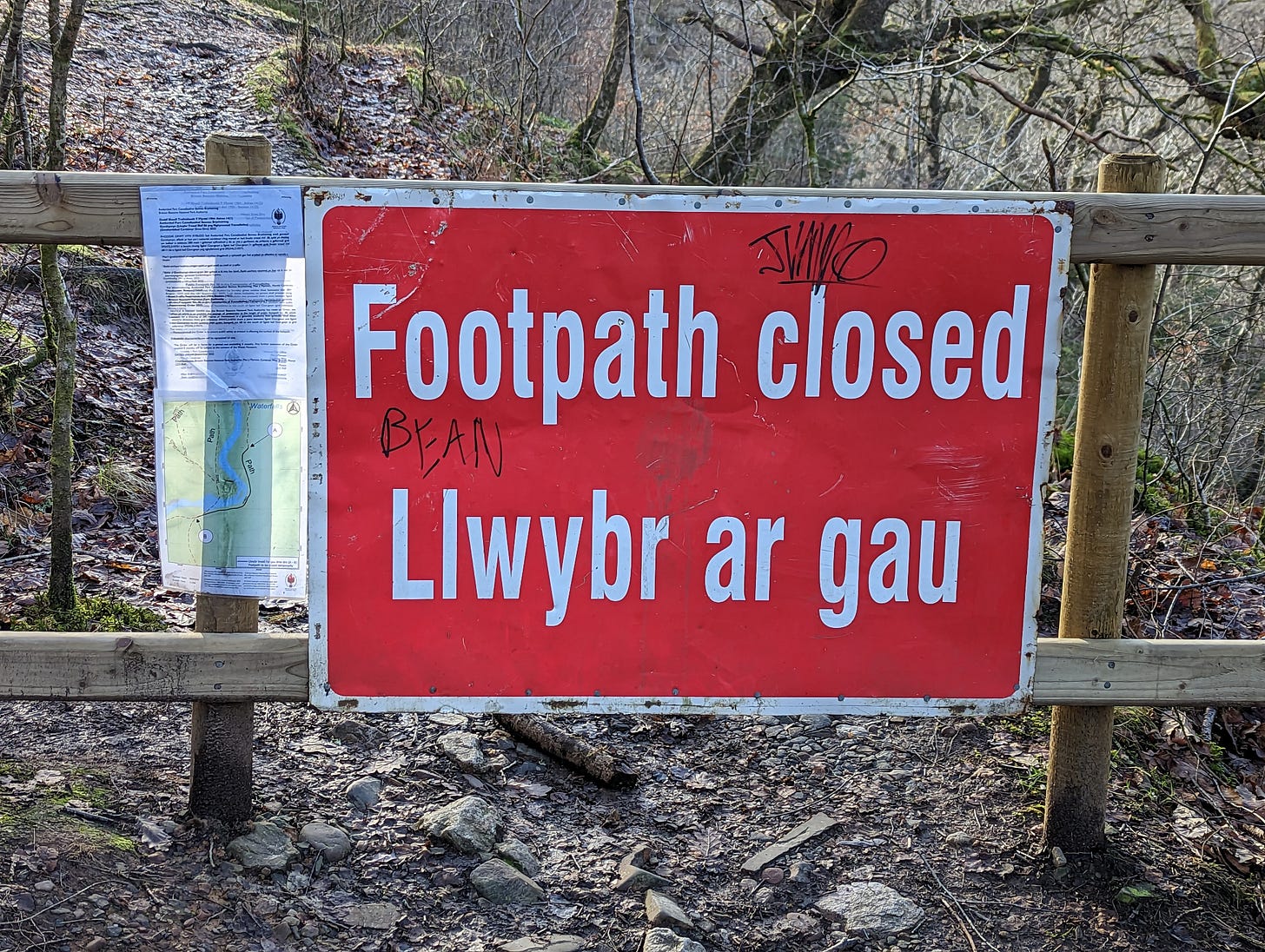
'The wardens delivering the signage in the waterfalls area of the BBNP have long been on the receiving end of criticism from me, for poor and confusing signage which to date they have not been able to remedy. Today there is a closed path. No signage at the start of the path when walking from Gwaun Hepste car park. Visitors reach a hastily erected barrier with a 'Footpath Closed' sign attached and no further instructions. I have been at this location and have assisted multiple groups and individuals who simply did not know where or how to safely proceed.
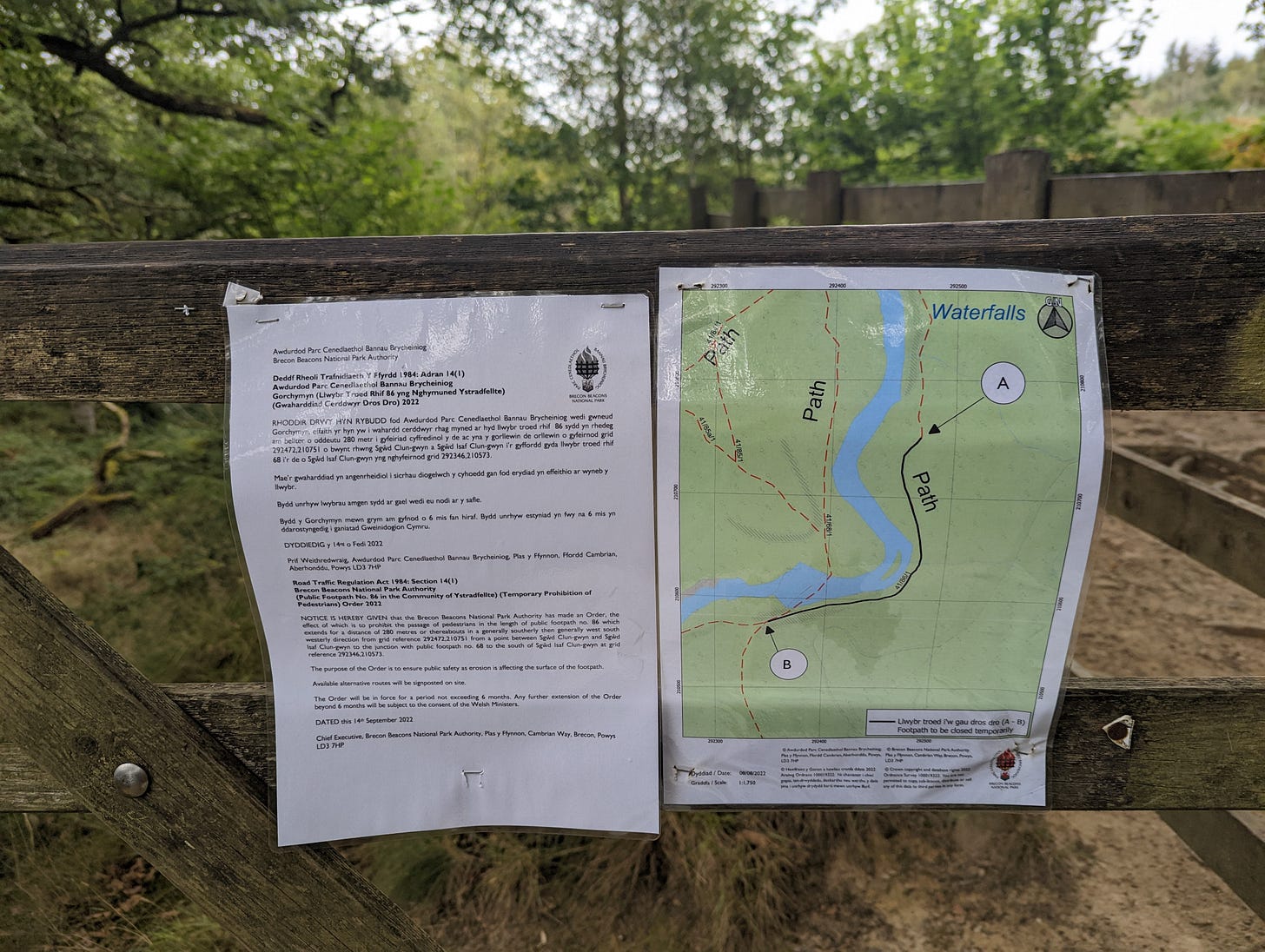
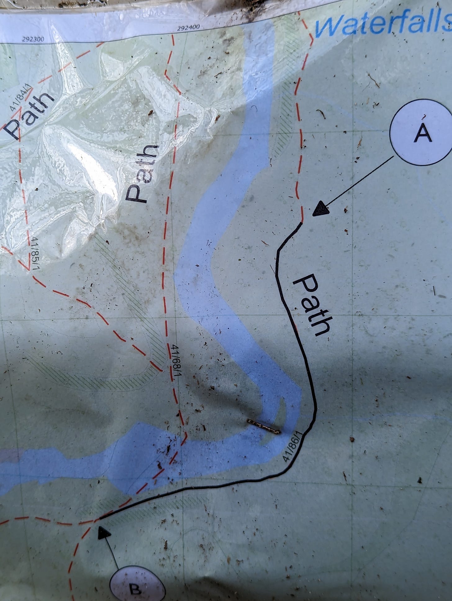
Then I saw this (see photo), now missing, (I was a back a day later and the stapled on information had been removed) and which shows the closed path and the available alternatives. I spotted this in one location and at a point where most do not wander, it not being part of a natural circular route.
To understand the map you would need both local knowledge and a good understanding of both mapping and use of maps. The map indicates only one alternative route and this involves a river crossing above a waterfall.
This is both dangerous and misleading (as I have not seen walkers other than gorge walking groups use this crossing) and indicating an alternative that crosses a river above a waterfall has to be seen as jeopardising the safety of members of the public, and in an area where serious accidents and deaths have occurred.
The dangerous path that has been closed I have been walking with groups for years. It's safe given good footwear and sound advice. However, I do understand the authorities concern and they really ought to be working to make good the one section of just a few metres that is most perilous.
Once again, and I am so fed up of saying this, shame on the BBNP for their abject failure to work for the publics' best interests. Most at this point walk up and away from the river and onto the main track. This is hazardous in itself and any accident at this location must in part, until the BBNP sort out the signage (again I've been asking for this for a good long time now, at least a year), be the responsibility of the BBNP.’
I clearly warned the authorities about the danger of the area and the non-response to my email is telling… On to Sunday just gone in the same area…
The sad news of two women drowning in the waterfalls area of the Brecon Beacons National Park, sparking a five-day search for one, reminds us all of the dangers of the locality where over the years very many people have become injured or indeed have drowned. There were a variety of headlines but as is the way in these instances detail was not provided and so identifying the point of ingress has escaped me. However, I led a guided walk in the area on Sunday and came across a series of new fences (put up before the deaths I am sure) and new signage.
For years I have been complaining to those who manage the area, Natural Resources Wales and the Brecon Beacons National Park, regarding signage and poor footpath maintenance. Indeed there have been many email exchanges this year, last year and the year prior to that all complaining of what looks likely to be the location where the two women lost their lives. However, this must remain as conjecture as I cannot pin down the exact spot.
I photographed all of the signage and information provided and I walked with my group away from the area in question. I here publish those images with commentary.
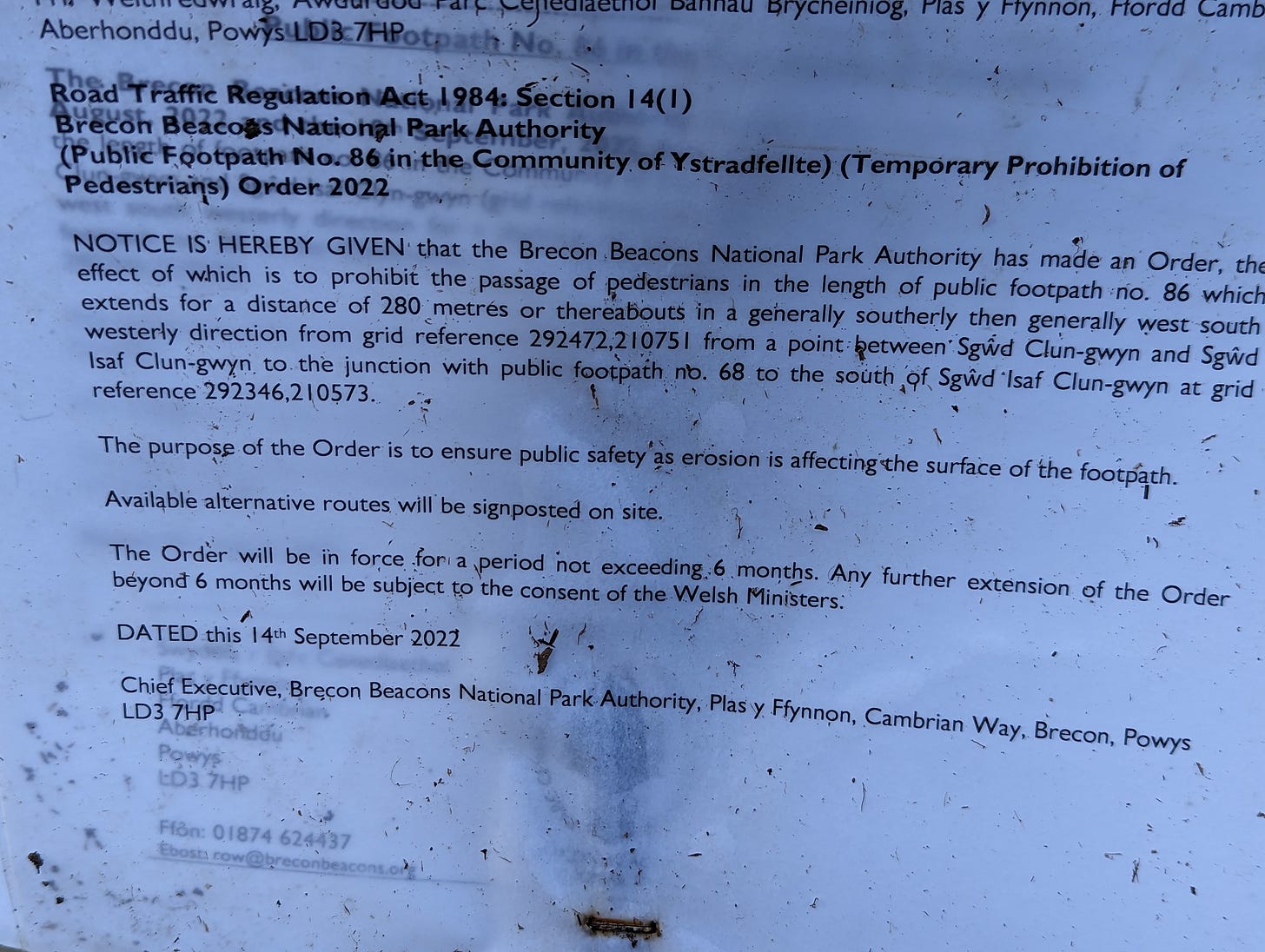
Here is the planning authority for the removal of access to the public along a section of path which has steep drops. It has not been deteriorating over time although one metres length could have been worked on to improve safety. However, the authorities most likely will decide on a permanent closure as I have seen no works commence on the path since the notice was first posted.
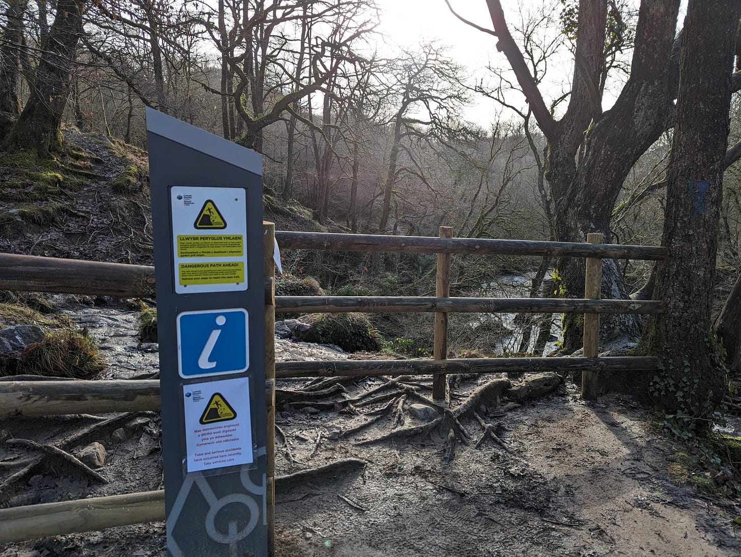
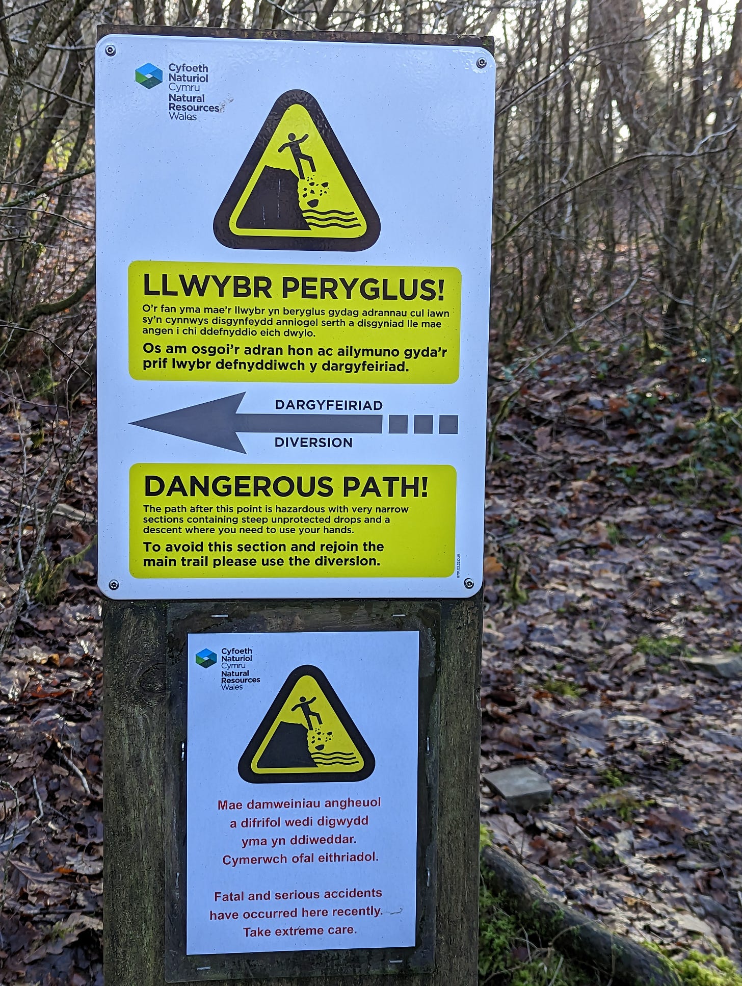
A fence with a gap and a notice stating dangerous path ahead has been put in place.
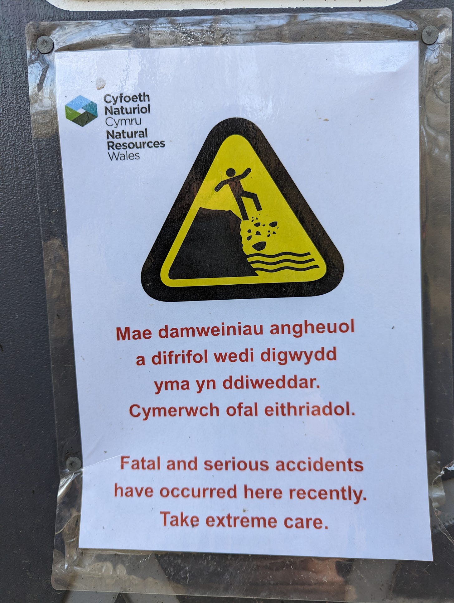
This is the temporary lower signage stating that deaths had occurred recently near this location.
This is what you meet approaching ‘the dangerous path’ from the Clun Gwyn side and it was here that I took note of the map, as detailed in my ignored email of the 26th September 2022.
The map is a disgrace, please see see my email of the 26th September 2022 published at the start of this post. Imagine being someone who is not familiar with the area and knowing you are near the point marked ‘A’ and wanting to get to the point marked ‘B’, well, you might just be tempted to cross the river to get to the path on the other side. You might decide to go to river level and walk downstream to point ‘B’. The path marked as 48/68/1 clearly crosses the river and it does so above a large cascading waterfall. It is only sensible to use this in summer and after a prolonged period of dry weather. I pointed out this misleading of the public in my email to Judith Harvey, BBNP warden. But the map remains, four months after my first warning of the dangers of informing people, by dint of the published map, of these footpath options.
As with all diversions there is ambiguity, but that really ought not be the case in dangerous areas of the great outdoors. On Sunday we followed the diversion only to find that as we joined a main path there were no further instructions or signs. It was then clear to me that a rough path a couple of hundred metres along, to the right, could well be mistaken by someone not familiar with the area as the route that gets them to point ‘B’. It does get there but it is steep and more dangerous to walk down that the ‘dangerous path’ that is now closed to visitors. Absent further instruction I wonder how many tourists have made the mistake of walking down this path?
I could not check on the signage at the ‘B’ end of the closed path as I had clients and we needed to get to Sgwd yr Eira, but the last time I was there signage was not to be found. If that’s the same now then this means that the closed path remains open in one direction, as absent signage, the casual visitor is not to know of the diversion.
I spotted no other instruction along the main path, at the point leading to ‘B’ in particular, that indicated the continuance of that route and so onto ‘A’ was closed.
I believe that this location in the popular waterfalls area of the Brecon Beacons National Park is so poorly managed that it will be a danger to visitors for some time to come. My warning of deaths in the area sadly, on this occasion, came true and my condolences are with the families of the deceased. It’s now incumbent upon natural Resources Wales and the Brecon Beacons National Park to solve the problems and remedy the path issues with groundworks and in good time as in a few months and we’ll be approaching Easter and that is when the area sees high numbers through to September.
I also ask for Natural Resources Wales and or the BBNP to let me know of the location where the women who a week past so unfortunately died first got into trouble.
I’ve copied this post to both the Brecon Beacons National Park and to Natural Resources Wales and Wales Online and if they respond I will add an update here and in the chat.


